Ballaugh
Abbeyfeale
Residential Land
Asking Price €59,000
Contact Sherry Fitzgerald Stack
PSR Licence: 001412
+353 68 32087
Property Overview
Status
For Sale
Land Type
Residential Land
Property Financials
Price
Asking Price €59,000
Property Engagement
Views Last 7 Days
16
Views Last 30 Days
101
Views All Time
294
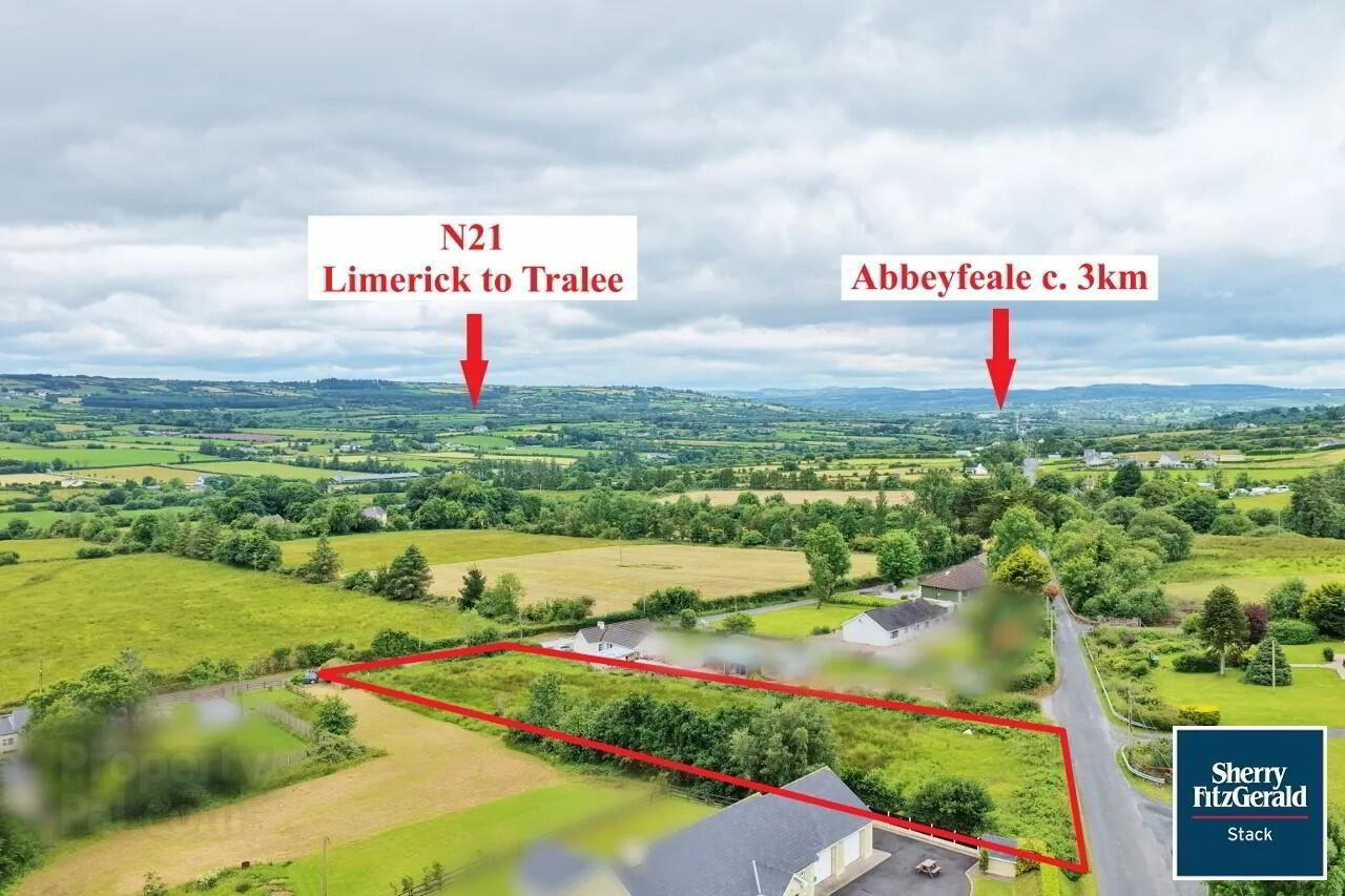
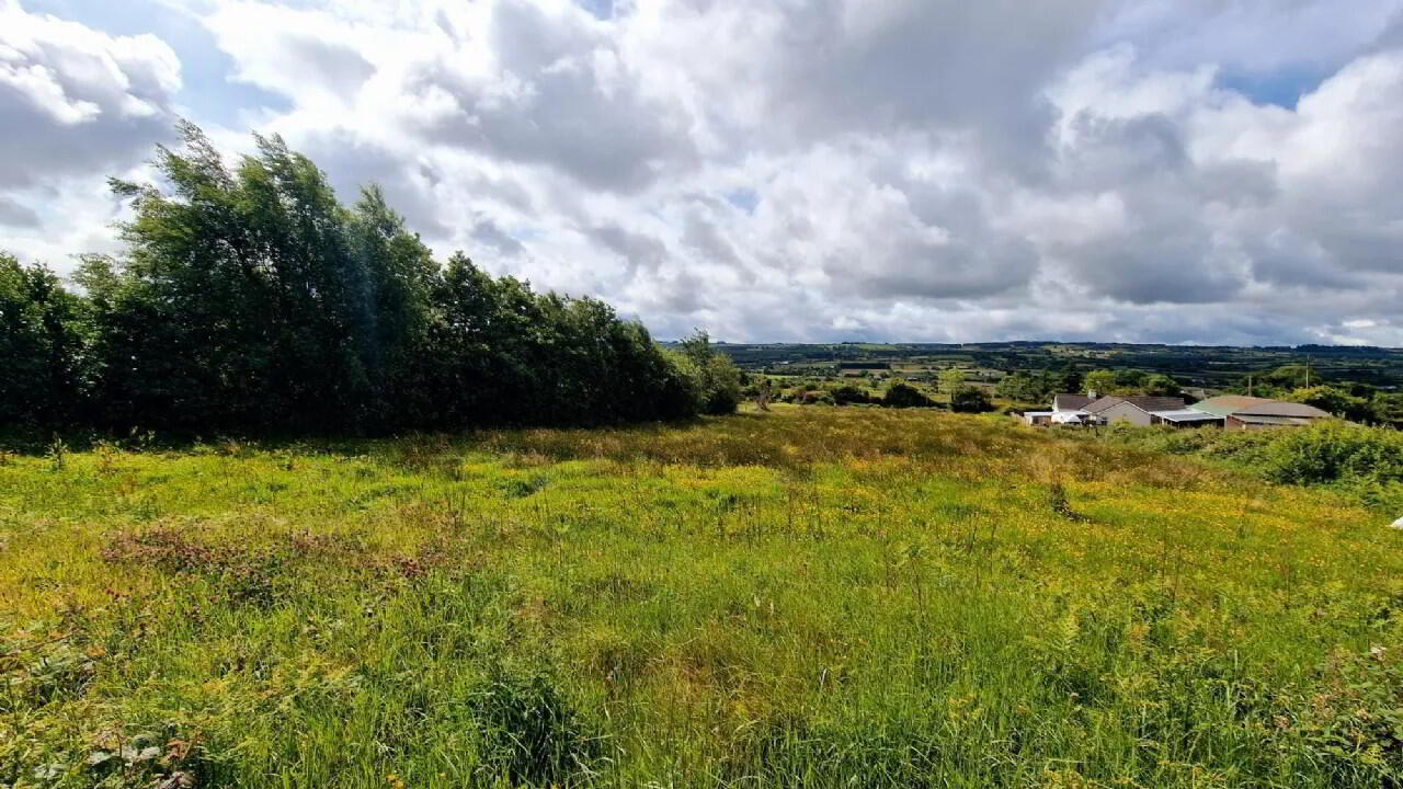
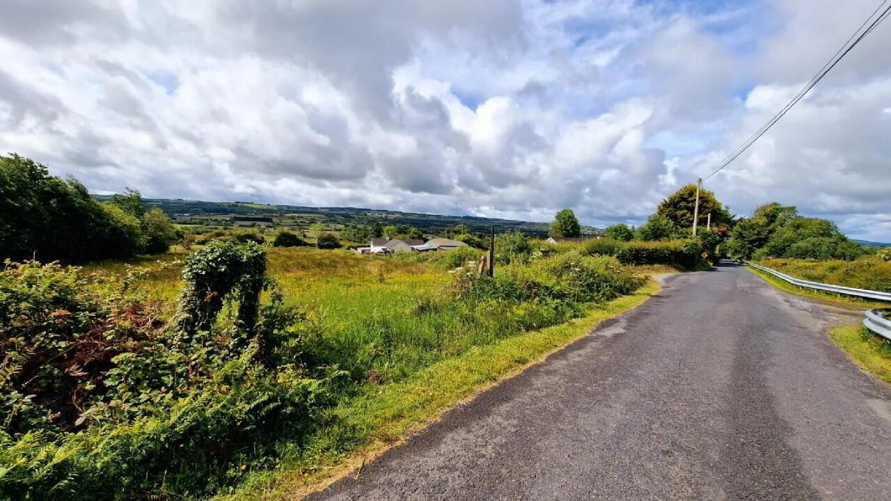
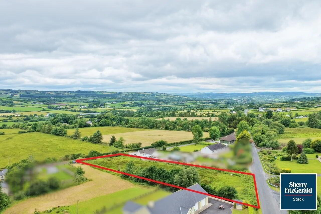
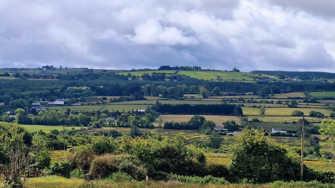
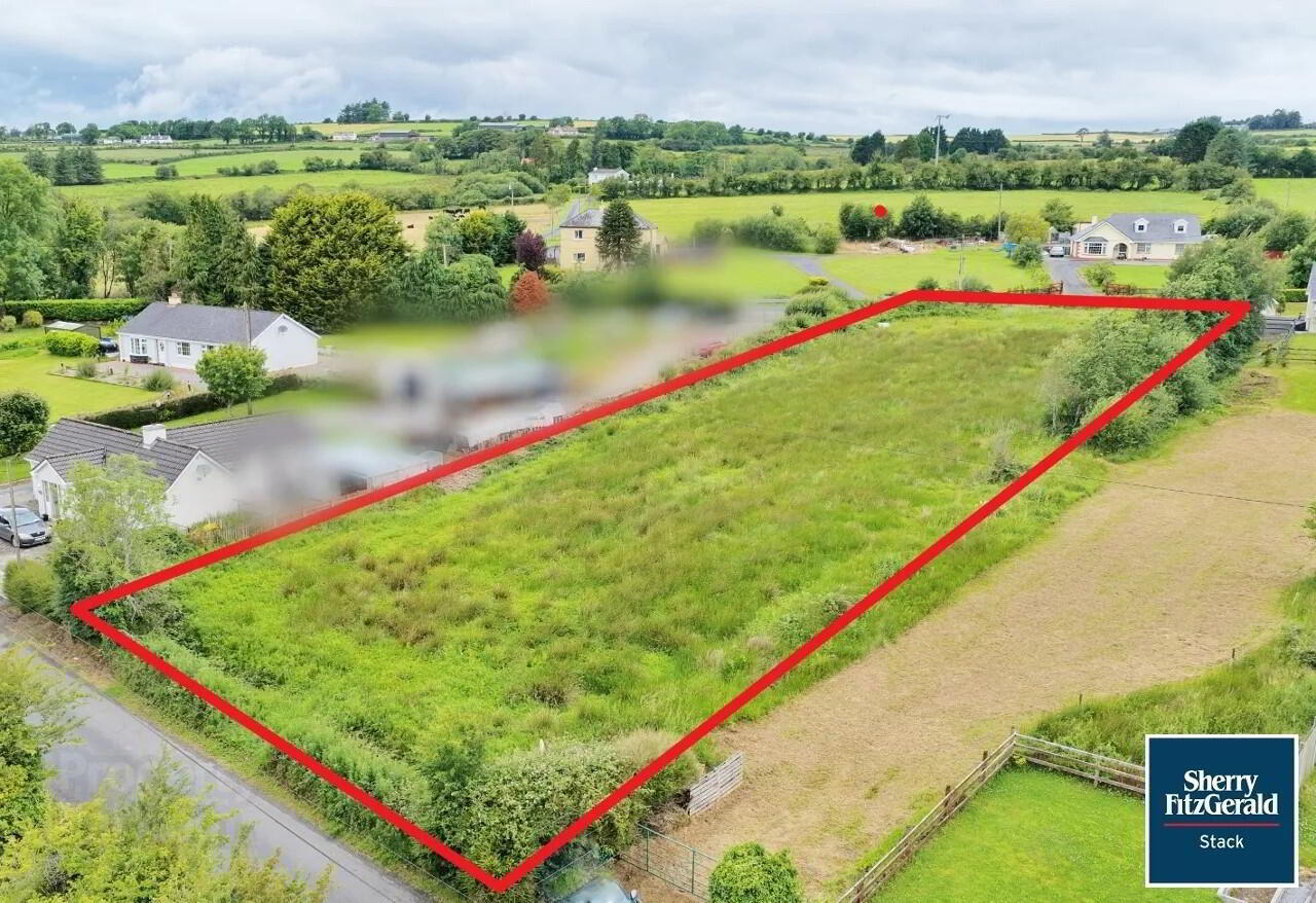
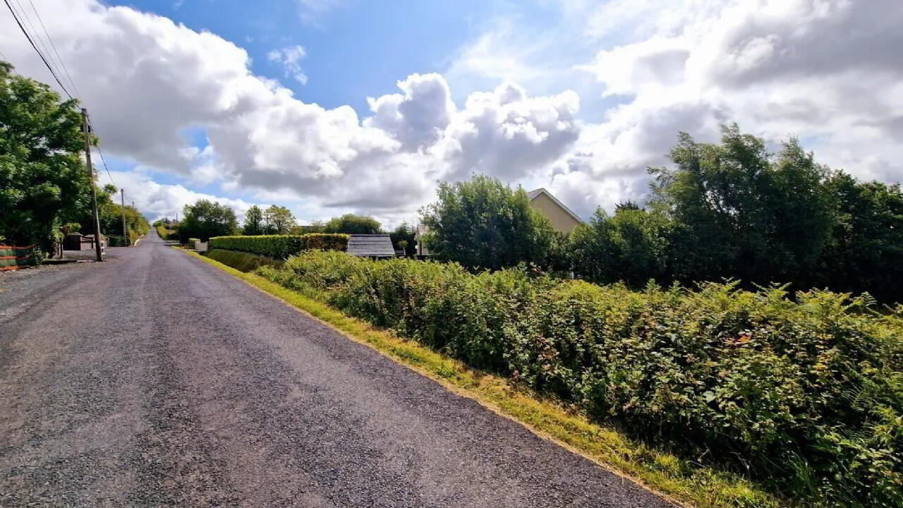
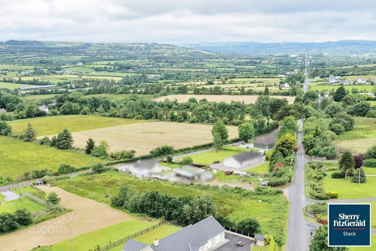
***For Sale by Private Treaty*** An excellent opportunity to acquire a well-positioned residential site extending to approx. 0.73 acres (0.29 hectares), offered for sale with planning permission granted for the construction of a dormer style dwelling house, domestic garage, entrance, driveway, wastewater treatment unit, polishing filter and all ancillary site works. This attractive site benefits from dual road frontage onto two public roads. Conveniently located just 3km from both the N21 (Limerick–Kerry route) and the market town of Abbeyfeale, the site enjoys ease of access to a wide range of local amenities including schools, shops, church, town park, pubs, and restaurants. The recently opened Limerick Greenway, a popular walking and cycling route, is also nearby. Mains water and electricity connections are available at the boundary, making this an ideal residential site.
For more information and particulars please contact Sherry Futzgerald Stack sole selling agent.
Abbeyfeale is a historical market town in Limerick, near the boundary with County Kerry. The town is in the south west of Ireland, some 21 km (13 mi) from Newcastle West on the N21 – the main road from Limerick to Tralee. The town is situated on the banks of the River Feale in the foothills of the Mullaghareirk Mountains.
The town previously had an abbey, located in the centre of the town square. Church street as it is now know was originally named Chapel street, as can be seen in old period OS maps of the town. The Geraldine Portrinard Castle (or Purt Castle) is situated about 2.5 km northwest of the town, on the northbank of the Feale. An International Airport is planned, most likely to be located in Kilconlea.